


Services

Mapping and digital construction
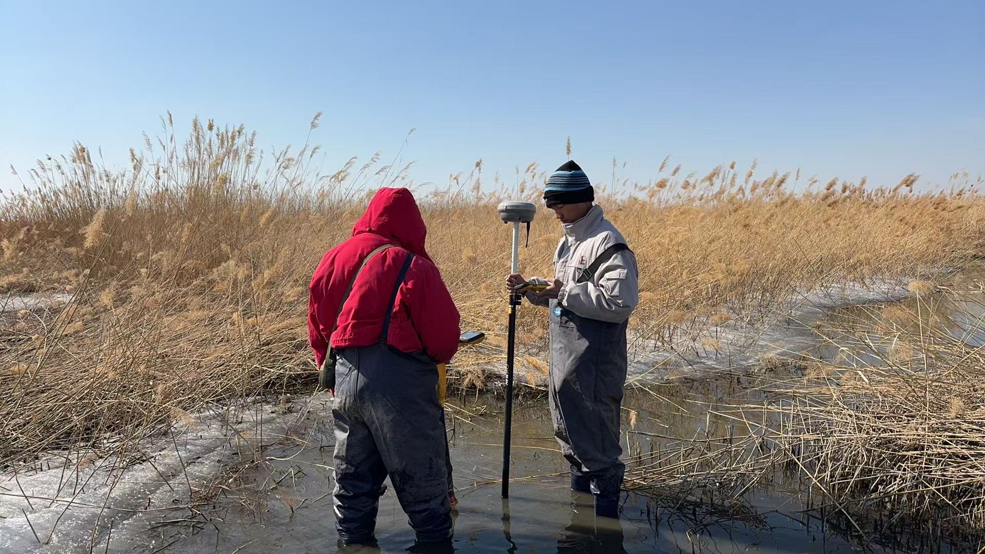
Map the location of the pipeline and its ancillary facilities as well as the terrain and geomorphology around the pipeline and the terrain and geomorphology around the stations and yards. Investigate the environment along the pipeline and around the stations and yards, and form the vectorization results of the line strip map and the terrain mapping and geomorphology results around the stations and yards. Responsible for the integration of pipeline surveying and mapping results into the system, and report the surveying and mapping results to the local planning and construction authorities for the record.
With Class B surveying and mapping qualification, with advanced and digital surveying system and aerial photogrammetry system, to provide accurate and efficient surveying and aerial photography technical services
Service
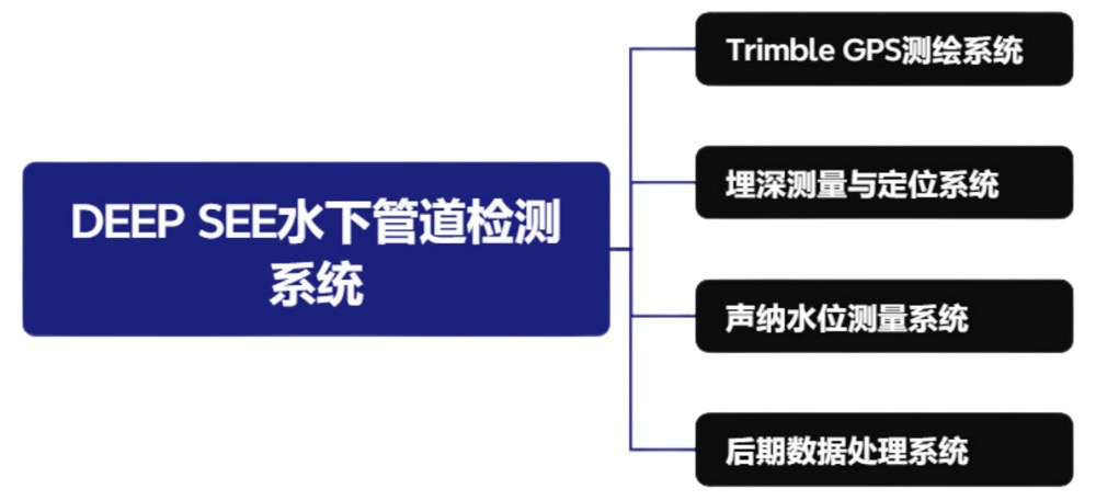
Underwater crossing pipelines, inspection services for ultra-deeply buried pipelines, and equipment R&D Mapping and digital construction In-pipe inspection and out-pipe inspection Automatic analysis of pipeline integrity evaluation and inspection dataCase
Underwater crossing pipe detection Internal inspection of pipeline magnetic leakage Pipeline mapping technical services
345133981@qq.com

Addr
8F, Kechuang Center, No. 2 Taoyuan North Road, Taoyuan Street, Ninghai County, Ningbo City, Zhejiang Province


Copyright © 2025 Ningbo Huitong Pipeline Technology Co., Ltd All Rights Reserved.
Zhejiang ICP for 2025148817-1
Copyright © 2025 Ningbo Huitong Pipeline Technology Co., Ltd All Rights Reserved.